







OCT 23 | 8:00 AM

Toutes les enchères / Livres, Cartographie & Manuscrits / Myanmar/Burma - Aracam (Arakan

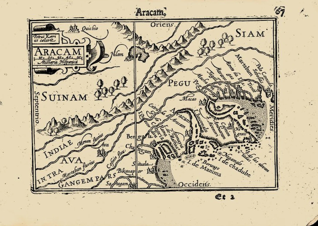
A small map of Arakan and Pegu, on the coast of present-day Myanmar, engraved and signed by Pieter van den Keere, from the first edition of Barent Langenes's Caert-Thresoor, the first Dutch pocket atlas, Middelburg 1598, with the Dutch description of Bengal on the verso. It is one of the earliest printed maps to concentrate on Burma. The emphasis is on the coast and the river mouths, the trading world of the seagoing kingdom of Arakan and its neighbour Pegu set out with east at the top. The margins on the right side slightly damaged; light discolouration at the top and right side. The Caert-Thresoor was the first Dutch pocket atlas: small copperplate maps by Pieter van den Keere (Petrus Kaerius) and Jodocus Hondius, each with a description of the country in Dutch, in an oblong octavo meant to be cheaper and handier than the great folio atlases of Ortelius and Mercator. It appeared in 1598, a year after the first Dutch voyage to the East Indies had returned, and it brought the geography of the whole known world within reach of a wider public. The plates proved durable: Petrus Bertius reused them for the Latin Tabularum geographicarum contractarum from 1600 and a French edition followed in 1602, so that the Dutch text of 1598 is the first and earliest form in which these maps were issued. In 1598 the coasts of Bengal and Burma were known in Europe almost only through the Portuguese, and the first Dutch ships had just reached the East Indies. A separate map of Arakan in a Dutch pocket atlas shows how quickly the Republic took up the Asian trade as its own subject; within a generation the Dutch East India Company was trading in rice and slaves at Arakan's capital Mrauk U. Suárez, Early Mapping of Southeast Asia (1999), fig. 107. Van der Krogt, Koeman's Atlantes Neerlandici, III, 341:01 (the atlas). Koeman, Atlantes Neerlandici, II, p. 254, Lan 1. Schilder, Monumenta Cartographica Neerlandica, VII, 16.1. Burger, Het Caert-Thresoor (1930). King, Miniature Antique Maps (1996).
Estimation:€1
Vers la vente aux enchèresVoir tous les objets deCatawikiouLivres, Cartographie & Manuscrits
Estimation:
€1
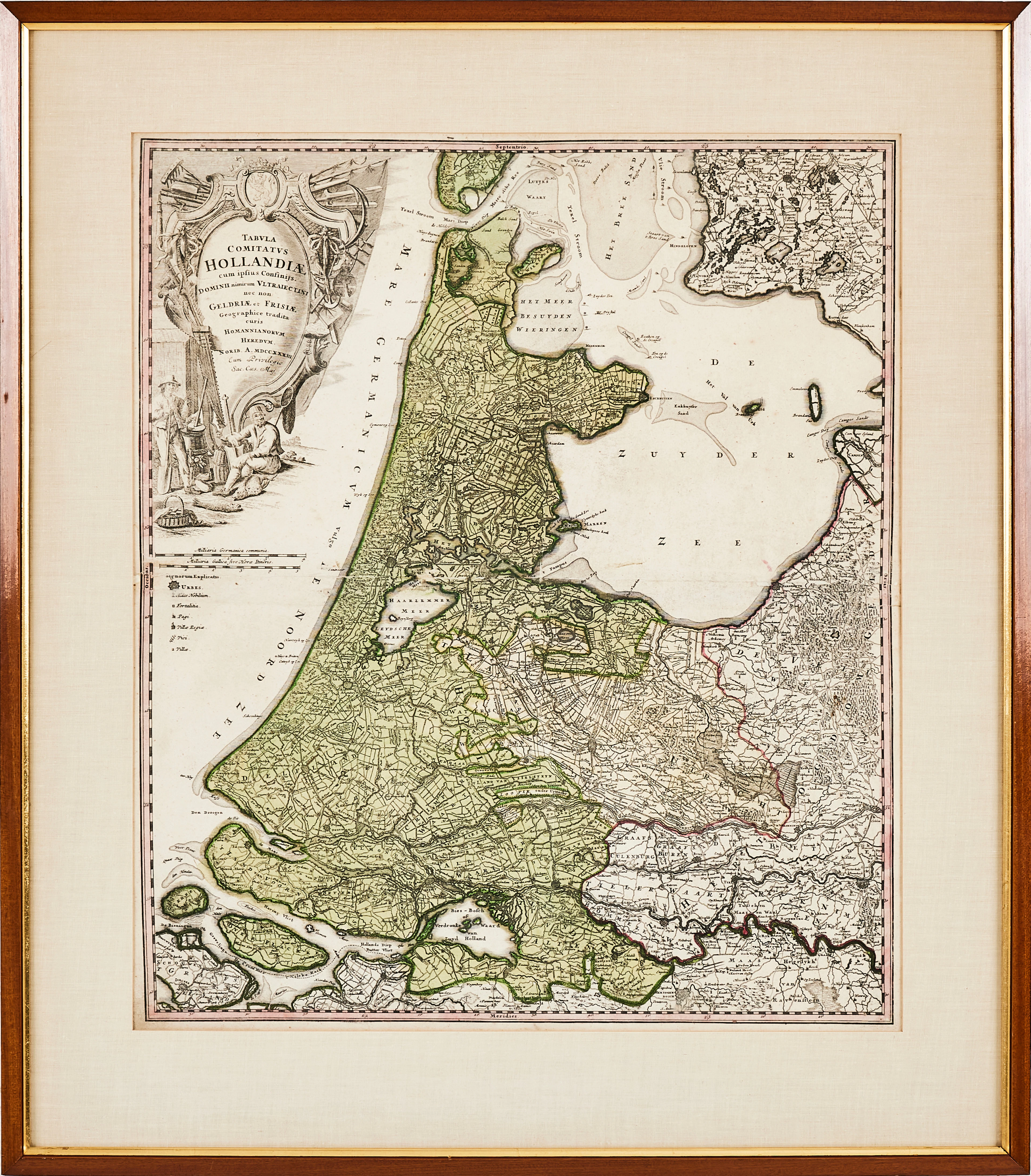
HOMANN, karta över Holland, 1788, "Tabula comitatus Hollandiae" kolorerat
10/12/2026
€89.58
Est. : €178.51
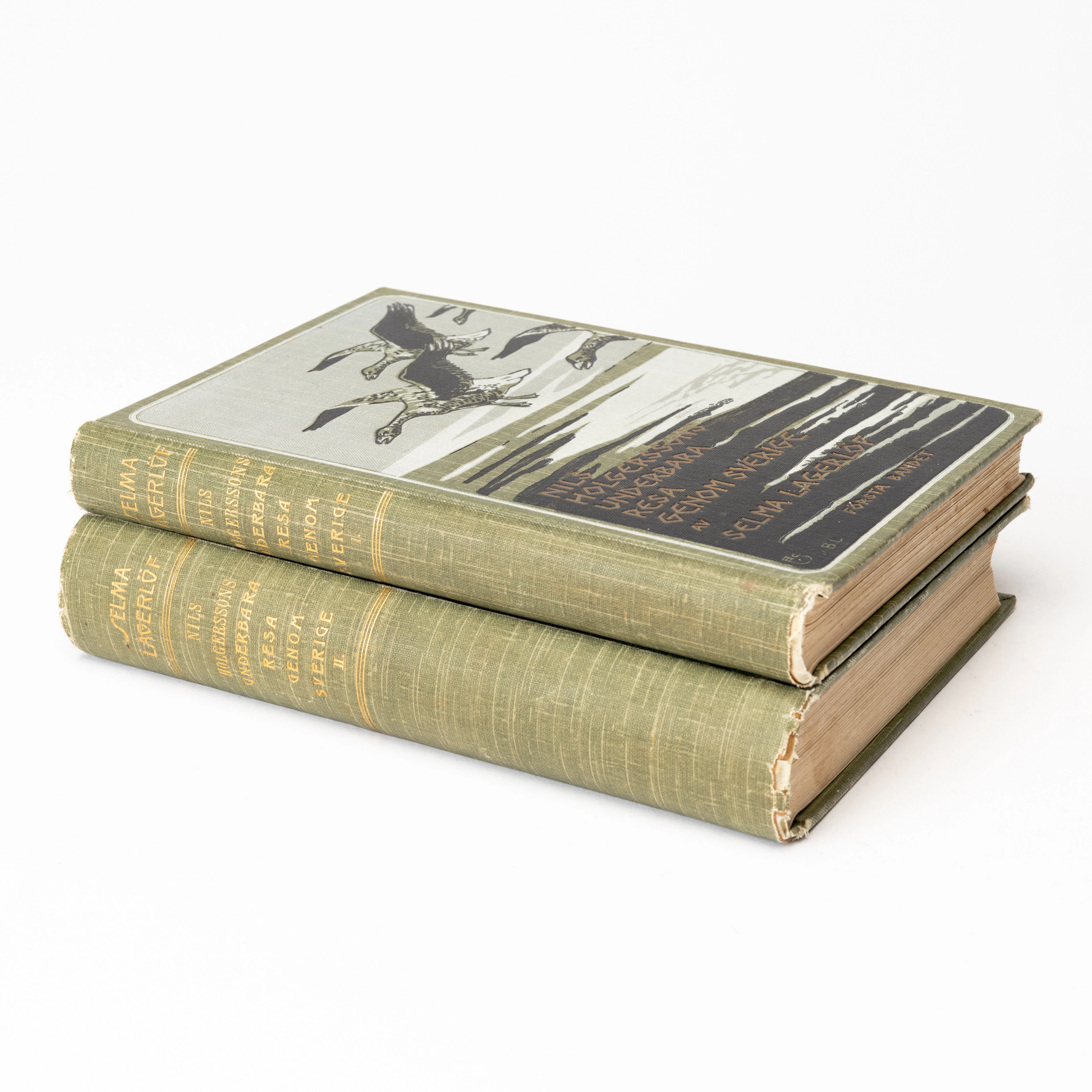
SELMA LAGERLÖF. "Nils Holgerssons underbara resa genom Sverige", första
10/12/2026
€80.62
Est. : €89.25
OCT 23 | 8:00 AM


OCT 27 | 4:00 PM


Présentez votre vente aux enchères à des collectionneurs du monde entier !
Soyez référencé dès maintenantEn vous abonnant, vous acceptez la politique de confidentialité. Désabonnez-vous à tout moment.
Barnebys HQ
Brahegatan 10
BOX 5038
114 37 Stockholm
